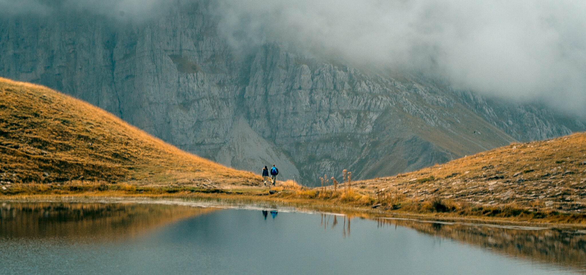
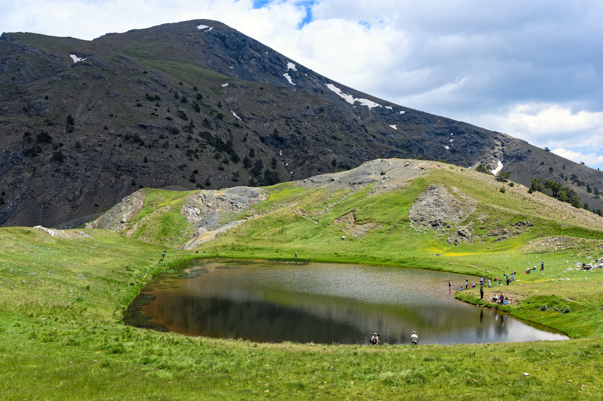
In the winter they freeze over, and a thick layer of snow buries them in solitude, but, starting in spring, things change. The snow melts, grass appears, and the lakes come back to life.
Climbers camp on their banks and the small, dragon like, alpine newts start swimming again. Many of these lakes dry out in the summer and have to patiently wait for the first autumn showers and the snow to start over, while others have water throughout the year.
The lakes are well hidden in the mountains in stunning settings. The only thing heard here is the quiet, interrupted by the wind and sometimes a sheep’s bell that is summering further down the mountain. It requires effort to reach most lakes, while some have dirt roads leading to them. Each one is unique and more than worth the effort to reach.
Tymfi Dragon Lake
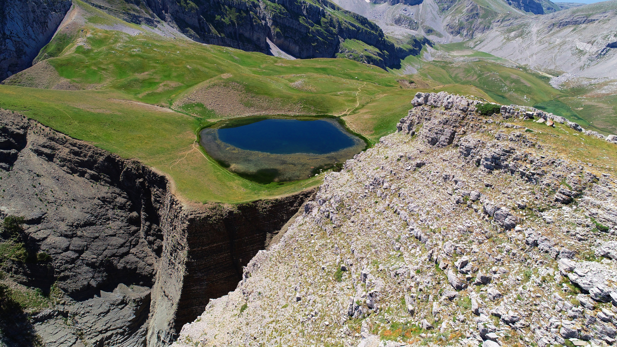
The most famous alpine lake, also known as a Dragon Lake, in the country is located up high, at 2,050 m altitude, just beneath the peak of Gamila on the Tymfi mountain range. It has a perimeter of about 5,000 m and its shape is elliptic. It’s located in the middle of a depression surrounded by tall rocks and hills. Not far from there, on the one side, stands the towering top of Gamila, while on the other side, there’s a cliff, with river Aoos in the distance, and across from it there is a mountain mass hiding Papigo. The Astraka refuge that overlooks the Xirolimni (a seasonal alpine lake), the canyons and the mountaintops is also close. Vegetation is scarce, alpine. Just a thin layer of grass, and that only in spring. The landscape is harsh and gentle at the same time, but most of all, it’s breath-taking.
A myth connects the Tymfi Dragon Lake to the Smolikas Dragon Lake that’s just across from it. According to the myth –even though there are many versions–, two dragons, who didn’t like each other very much and often fought each other, lived in the lakes. The Tymfi dragon would throw logs and branches to the Smolikas one and he would throw white stones back. That’s how the locals explained why the mountaintops of Tymfi are bare of trees –the dragon had torn them– and why there are white stones among the black ones in the lake.
To get there, you need to go on the O3 trail from Mikro Papigo, the most popular hiking trail second only to the one that goes to the top of mount Olympus. The lake is not accessible by car, only donkeys go there that carry the supplies to the refuge. The trail is marked with red paint markings and is relatively easy, but it takes a few hours and is tiresome, so you need to be very careful. At first you walk in a forest of oaks and cypresses, that turn into firs while there’s increasingly less and lower vegetation as you keep walking. At about 1,500 m elevation, the vegetation turns alpine, you’ll only see a thin layer of grass and small flowers. The distance from Mikro Papigo to the Astraka refuge is about 3-4 hours, depending on your skills, and from the refuge to the lake you’ll need another 1,5-2 hours. On the way you’ll come across gazebos and four fountains where you can rest.
Gistova Dragon Lake
It’s the largest alpine lake in Greece, located at the highest elevation, at 2,350 m on the Grammos mountain range, on the borders with Albania. It lies on a depression surrounded by mountaintops. It’s not very deep and the bottom is covered in grey stones. The landscape is stripped-down here too, with just a bit of greenery in spring, when the snow melts. Here the snow season lasts longer. In the winter, it freezes over, and it is not accessible until at least the middle of spring. Within the steep rocky landscape, as you climb the mountain, Gistova is a revelation, a very unexpected surprise.
This lake also has a myth. It is said that a harmless dragon lived in a nearby village, but the villagers decided to send him away. So, they led him up in the mountain, to isolate him. The dragon, saddened by the villagers’ cruelty, asked to rest just above the village and there he shed a tear that became the first dragon lake. When they reached a spot where he could no longer see the village, at the top of Grammos, he shed a second, larger, tear, and that turned into the larger dragon lake.
The lake is only accessible on foot from the village Grammos, and the hike takes around 4 hours. The owners of the Grammos Lodge refuge, located in the village, can give you detailed directions about the trail.
Also note: on the slopes of Grammos, at 1,740 m altitude, between Kastoria and Ioannina, at the location Moutsalia, very close to the borders with Albania, there’s a dreamy lake surrounded by tall beech trees. If you’re not great hikers and are not up to the task of visiting the Dragon Lake, then you can visit this lake, that is accessible by dirt road either from Aetomilitsa or from Pefkofito, in Kastoria.
Smolikas Dragon Lake (Lygas)
You’ll reach it after quite some hiking, in the heart of Smolikas, at 2,200 m altitude, where the mountain turns green only in the spring. It’s the second largest alpine lake in the country, with a perimeter of about 4.000-6.000 metres. It’s quite deep, though the exact depth has not yet been measured, and its shape is irregular, resembling a heart, while there’s a small opening on one side creating a stream that falls off the cliff. The view from the lake is limited, but if you climb a few steps higher you’ll see an endless field of mountaintops spreading in front of you. Its waters are usually bright blue, that’s why the Vlachs call it “Lakou-Vinitu” that means blue lake, however, near the banks, the bottoms turns red. Mostly during spring, apart from the green grass, you’ll also see lilies, wild orchids and violets growing around the lake.
Maybe according to the legend in Tymfi, the dragon living in Tymfi lake won the battle with the dragon of Smolikas lake, but here the story ends differently. The winner here is, of course, the dragon of Smolikas, since according to the legend, he wasn’t throwing stones but giant lumps of rock salt, that his opponent consumed, and then, to quench his thirst, drank too much water and died. The legends don’t stop here, it is also said that a shepherd fell here and drowned after having his heart broken, and that his evil spirit haunts the lake, while a third myth says that a golden ram lives in the lake’s bottom that would come out of the lake and mate with local ewes, “spoiling” them, and when the shepherds hunted the ram, they drowned in the lake.
The lake is accessible from the village Paleoseli, with or without a stop at the Smolikas refuge, by a trail of medium difficulty and also by a forest road. You’ll reach the dragon lake through a lovely pine and Bosnian pine forest. It’s around two hours away from the refuge. Another route is the one that starts at the village Pades. On the dirt road, either by car or on foot, you’ll reach 1,900 m altitude and then you’ll need to climb on a trail for about 1.5-2 hours. There’s also a route from the village Pournia, towards Klefti, and then up until the lake, but I don’t see why anyone would want to bring noise and exhaust gas to this magical unspoilt place.
Flenga Dragon Lakes
The two small but gorgeous lakes are located inside the Pindos National Park, above the village Milies, near Metsovo, and above the artificial lake of Aoos. “Laklou Mare” and “Laklou Nikou” as they are called in the Vlach language, are located at 1,960 m and 1,940 m elevation respectively and are just a few metres away from one another. The lake that is higher is larger, around 5,000 m in perimeter, and through a small steam it supplies the smaller one that has a perimeter of 3,000 m, whose water, when it overflows, heads towards the Arkoudorema river. Here the landscape is subalpine, which means you’ll find a few scattered firs in the area around the lakes. It’s worth going up to the lakes just to see the panoramic view of Valia Calda, that means the warm valley.
Like any self-respecting dragon lake, the Flenga dragon lakes also have their own myth. According to that, there were two dragon brothers in the area that lived in facing peaks. One of them in Avgo and the other in Flenga. At first the two brothers went along, but one day they met a beautiful young woman while they were hunting, and they fell in love with her. So, they started running behind her, to woo her, but she was scared and run away, crying and fumbling. The lakes were created from her tears. But the brothers kept fighting, and their mother, angry, came out of the earth like a foaming current, and it is said that that’s how Valia Calda was created. Another legend speaks of Pindus, the son of Macedon, who was killed by his brothers. When his dragon friend, Lygos, found him dead, he cried and his tears created the lakes, while he named the mountain Pindos to honour his friend.
There’s a forest road that reaches the Aoos Refuge and then a trail goes to the lakes (make sure to ask about the road before heading up). There are various paths leading to the lakes, like the one that starts at Arkoudorema, at the confluence with the Mnimata stream, or from the Salatoura stream, but also from the Salatoura Milias col, along the Mavrovouni ridge.
Verlinga or Vringa Dragon Lake
It’s probably one of the most beautiful alpine settings. In spring, everything is covered in green with small yellow and purple flowers, streams and small waterfalls, making it, together with the alpine lake, a unique scenery. The lake is above the village Chaliki, near the Aspropotamos springs, the source of river Acheloos, on mount Lakmos, at 2,050 m altitude. Vringa in the Vlach language means circle, thought the lake is not exactly circular it has this name because it swirls and eddies, creating beautiful formations. You’ll come across campers and herds of sheep spending the summer in the mountains, and if you’re wondering how you’ll get there, don’t worry, there’s a road that gets very close to the spot, and then you need to hike for a bit. The hike there, even though tiresome, is magnificent, it’s truly a masterpiece of nature.
According to the legend, a dragon shaped like a snake burst out of the mountain’s rocks, and then following a winding course buried himself in the earth. That’s where the waters that form Aspropotamos and then Acheloos start. The place where the dragon burst out is where the water begins, following the same course as the dragon. The shepherds also call the lake Farmakolaka (poisoned basin) because legend has it that the animals that grazed at its banks died.
The path starts from Chaliki’s square, goes down the gorge, continues on the forest road and leads up to the lake. There are also paths starting at the dirt road that cross the thick fir forest.
Lakkou or Arvanita Dragon Lakes
On the slopes of Tymfi, just before the scenery changes, and the grey rocks take over, near Iliohori, there are two alpine lakes known as Lakkou or Arvanita. They are located at 1,400 m altitude and they collect the water that slides off the mountain when the snow starts to melt. The landscape is mixed; thick fir and beech trees surround the lake while above them stand the steep rocky slopes of Tymfi.
Access is pretty easy since you can get there by car. Just before Iliohori, at the junction that leads to the village Laista, you take the dirt road on the left. However, because in the winter the road closes from the snow and the landslides, it’s best to ask at the village if it’s accessible before you head up there.
Read also:
A magical journey through four unique lakes in Florina
A stunning place in Northern Greece “leaning” over a wonderful artificial lake
24 hours at Lake Plastiras, a stunningly beautiful kaleidoscope of colours


